
Trace a Middletown Street by Address
A useful street directory search begins with the physical parcel, not with an assumption about who lives there. Search a known number or street in the Middletown GIS application, select the parcel, and write down the PID, map-lot, situs address, and owner fields. Then open the matching assessment card, use the owner or legal description in the deed index, and compare the result with sources that record civic or historical activity. Each source answers a narrower question. A property card is about the record owner and parcel. A deed is about a recorded transfer. A reverse directory is about a named occupant or business in a particular year.
- Fix the address. Run the street or number through the GIS search, select the parcel, and preserve its PID or map-lot before moving to another source.
- Read the card. Open the same parcel in Vision Property Lookup. Compare Location, Owner, Owner Address, account, map-lot, building, and sale-history fields.
- Check the civic route. If the question concerns one named person, use Connecticut MyVote for the available registration or polling-place response. It is not a public browse of every household on a street.
- Follow the title. Search the owner or grantee in RecordHub, record the instrument and book/page lead, and use the legal description when the street number is not stable.
- Go backward for occupancy. Use the reverse section of a local directory, then compare a second year with census, newspaper, probate, or vital-record evidence. Russell Library can help identify the right reel or volume by appointment.
The chain is best kept as a short worksheet: address to PID, PID to owner, owner to deed, deed to predecessor, and address to historical occupant. That sequence makes a Middletown street directory citable without turning a mailing label or a parcel owner into an unverified resident claim.
Middletown Records That Follow Streets
Several Middletown custodians use the same address, but they do not keep the same kind of person record. The table below shows how to combine them. The City Assessor and GIS supply the current parcel frame. The Town Clerk supplies the local land-record route. Building files use the same map, lot, and parcel identifiers, while directories and census material help with earlier occupants.
| Record Set | Keeper | Address-Based Detail | Access |
|---|---|---|---|
| Vision assessment card | Middletown Assessor | Owner of record, owner address, PID, account, map-lot, value, building, and sale-history fields | Public web lookup; current card |
| GIS parcel layer | City GIS | Situs address, map-lot, CAMA/PID, owner and mailing attributes, ZIP, districts, and adjacent geometry | Public map, table, CSV, and print tools |
| Recorded deeds and liens | Town Clerk / RecordHub | Grantor, grantee, instrument, file date, book/page, legal description, amount, and image indicator | Online January 1, 1969 to present; older books and images require another route |
| Building permits | Building Division | Project Address, Map, Lot, Parcel ID, Zone, Lot Area, applicant or owner, fee, and application status | Online application or written, mailed, or counter request |
| Voter public lookup | Middletown Registrars / Secretary of the State | One-person registration and polling-place response, subject to public-field and privacy rules | MyVote lookup; full-file access is restricted |
| Directories, census, and newspapers | Russell, Wesleyan, city scans, and archives | Historical occupant, household, trade, address, obituary, and community clues by year | Scans, shelves, microfilm, indexes, and appointments |
Use the parcel identifiers as the bridge. A street name can be shortened, a number can be recast, and a mailing city can differ from a situs city. A PID, map-lot, book/page reference, or legal description is usually a better citation point than a bare street string. The resulting street table should label each fact as parcel, title, permit, civic, or historical evidence.
Vision Modes for Middletown Addresses
The Vision Property Lookup search gives an address search several ways to reach the same property card. Address is the natural start for a current number. Owner works for a person or entity already tied to the parcel. Acct#, Map-Lot, and PID are better when a document or map gives a stable identifier instead of a clean street spelling.
The source-linked search screen shows the modes that make a Middletown address search practical, including the combined All option. It also makes clear that the public form is a property lookup, not a resident roster.
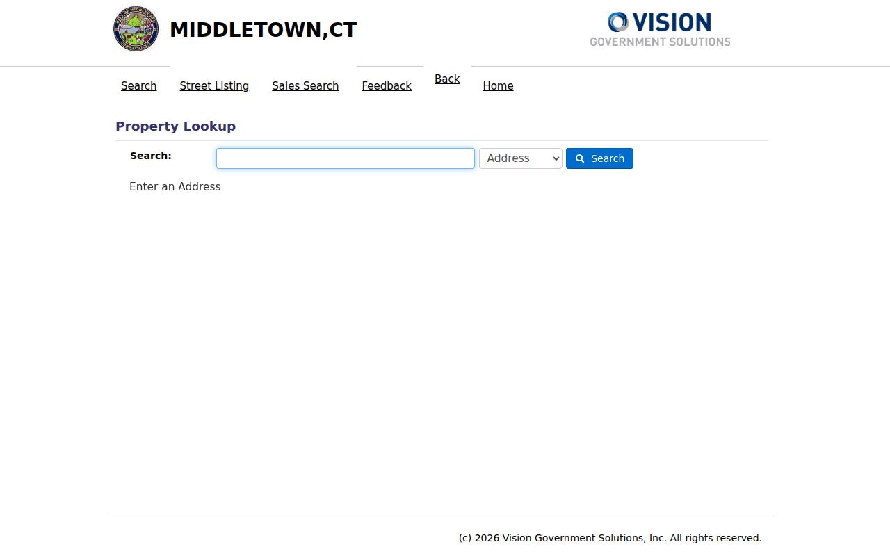
This view is useful for choosing a search key before opening the card. A result still needs a second record type when the goal is to understand an earlier owner, an occupant, or a name shared by several parcels.
| Mode | Field Type | Required | Street-Search Use |
|---|---|---|---|
| Address | Text or autocomplete | No | Minimum three characters in the implementation; search a number, name, or partial address. |
| Owner | Text or autocomplete | No | Minimum one character; the help text directs a surname or owner query. |
| Acct# | Text or autocomplete | No | Minimum one character; useful when a street number has changed. |
| Map-Lot | Two text inputs | No | Enter the map and lot values; each input supports the portal format and has a seven-character implementation limit. |
| PID | Text or autocomplete | No | Minimum one character; direct bridge from a GIS parcel to a Vision card. |
| All | Text or autocomplete | No | Combined source search; the exact match scope is not exposed in the public text. |
Vision also exposes Street Listing and Sales Search navigation. The full result controls for those modes were not visible in the inspected public text, so use them as optional routes and cite the result card you actually read. A past-owner implementation is not a visible public search mode and should not be promised as a service.
GIS Layers Around Middletown Streets
The city GIS viewer adds the spatial part of a by-street search. Its public search accepts Address, Owner, Account Number, PID, and Map-Lot. Once a parcel is selected, turn on Parcels and Parcel Labels first, then add roads, zoning, voting districts, flood zones, and other layers only when they answer the question at hand. The official Middletown parcel feature service exposes fields for the parcel identity, owner, site address, owner address, ZIP values, book/page, sale data, zoning, year built, and building characteristics.
The parcel layer itself is the source behind this linked view. It is a public research aid, while the Town Clerk remains the route for legal land-record proof and the Assessor is the right office for questions about the current assessment card.
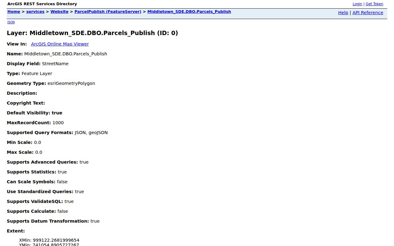
The map and its attribute data work best together. Use the map to see which polygons touch a street segment, then use the Attribute Table to preserve the selected rows, filter configured fields, or export a CSV for a citable research note.
| GIS Control | Field or Tool | Street Use | Limit |
|---|---|---|---|
| Address | StreetAddr autocomplete | Up to 10 suggestions and 200 results; zooms to a parcel | Exact match is false, so inspect the selected result |
| Owner, account, PID, map-lot | OWNER1, AcctNum, CAMA_ID, Parcel_ID | Cross-check the Vision card and group a street by parcel identity | Search is parcel-oriented, not a household search |
| Attribute Table | Parcels and Parcels-Mailing | View 25, 50, 100, or 1,000 rows; select, zoom, and export CSV | Rows reflect the configured public layer |
| Layers | Parcels, zoning, voting, flood, roads, and utilities | Explain a parcel's map and planning context | GIS data is informational; older public exports have a 1996 accuracy caveat |
| Abutters | Parcel selection and distance tool | Creates a CSV or PDF mailing list for adjacent parcels | It is not a list of every person at an address |
Insider tip: Record the selected PID, date, visible layers, table filter, and Abutters distance before exporting. That small log lets another researcher tell a geometric neighbor result from a mailing list.
Separate Middletown Address Fields
A street directory becomes unreliable when four different kinds of address are treated as one. Middletown's parcel systems keep these fields apart, and older directories may use a spelling or number that no longer matches the current map. Read the definitions before copying a name into a family-history note or a deed worksheet.
- Parcel
- A mapped property unit with a PID, map-lot or parcel identifier, geometry, and related assessment or land-record fields.
- Situs address
- The physical location of the parcel. GIS, permits, building inspections, Sanborn maps, and the Vision Location field use this side of the address record.
- Plat
- A recorded map or subdivision drawing that helps connect lots, boundaries, streets, and adjoining parcels to the legal description.
- Criss-cross directory
- A historical street-order section that moves from a number or street to an occupant, household, business, or institution for that publication year.
The owner mailing address is where assessment notices are sent. GIS exposes separate site and owner fields, while Vision places Location and Owner Address in different card areas. Neither mailing address nor ZIP label proves that the record owner physically lives at the parcel.
The source-linked Vision card for the Middletown Municipal Building demonstrates the distinction with a location, owner, account, map-lot, value, building, and sale-history layout.
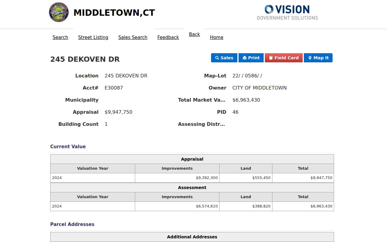
The card is a model for recording fields, not a claim about household occupancy. Its municipal ownership and placeholder sale row also show why each value needs its field label and record context.
Middletown Street Permits and Parcels
Building records add a project trail to the parcel trail. The Middletown Building Division application materials use Project Address, Map, Lot, Parcel ID, Zone, and Lot Area. The applicant and owner blocks also carry names and contact fields, while staff-use fields include an application number, fee, and decision or status information. Those labels let a written request match the same parcel found in GIS or Vision.
The source-linked permit page captures the address and map fields that make that handoff possible. It does not turn a permit into a title record. A permit shows a proposed or reviewed project and related paperwork; a deed shows a recorded interest; an assessment card shows the current public property record.
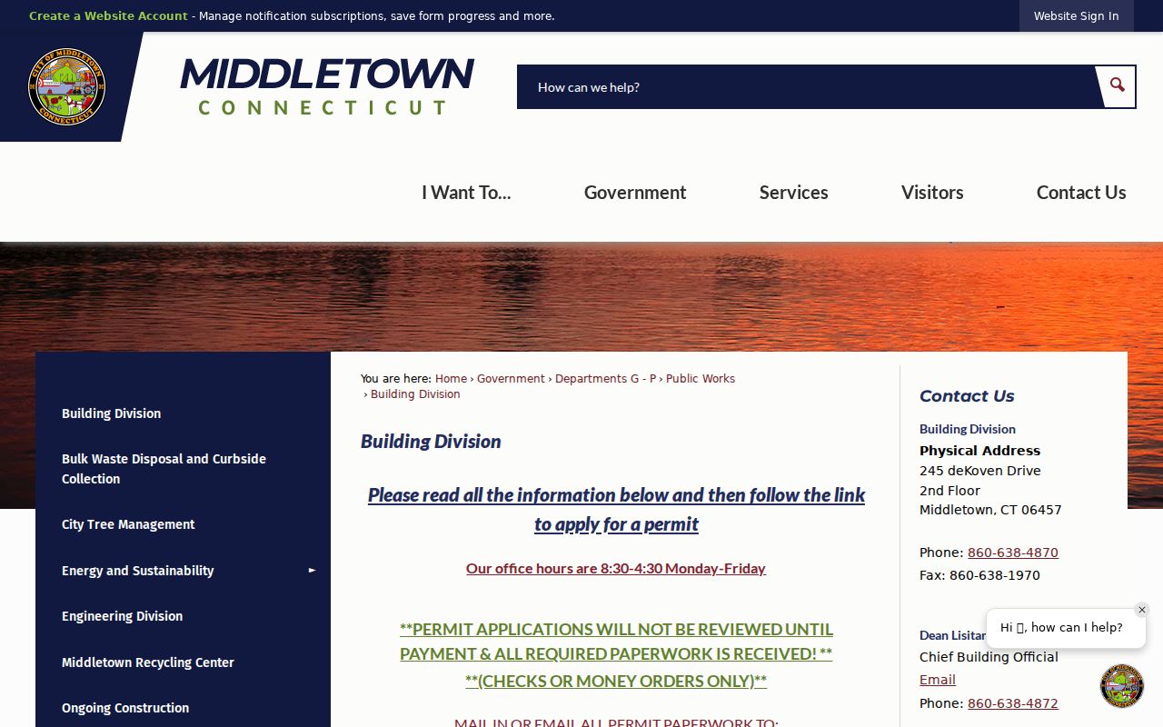
Applications may be emailed to building-permits@middletownct.gov or mailed to the Building Department at 245 deKoven Drive. The city states that full paperwork and payment are required before review, with checks or money orders accepted and no refunds. Permit-records technology questions use 860-638-4873; inspection scheduling uses 860-638-4870.
For an older address, ask with every identifier available: current and historic street spelling, number, map, lot, PID, zone, and the owner or applicant name. The official application page does not state a complete historical permit coverage start date, so requesters should ask what file years and plans are retained.
Middletown Deeds Behind a Street
The local recorder route is the Middletown Town Clerk, not a separate active Middlesex County recorder. The Middletown land-record page sends current online research to RecordHub, with an index and images from January 1, 1969 to the present. The Town Clerk counter is at 245 deKoven Drive, phone 860-638-4910. RecordHub offers a guest or no-subscription index route, but images may be pay-to-print or behind a subscription product.
The official land-record page is shown in the linked source image. It is a useful reminder that the online cutoff is a search boundary, not the beginning of Middletown's title history.
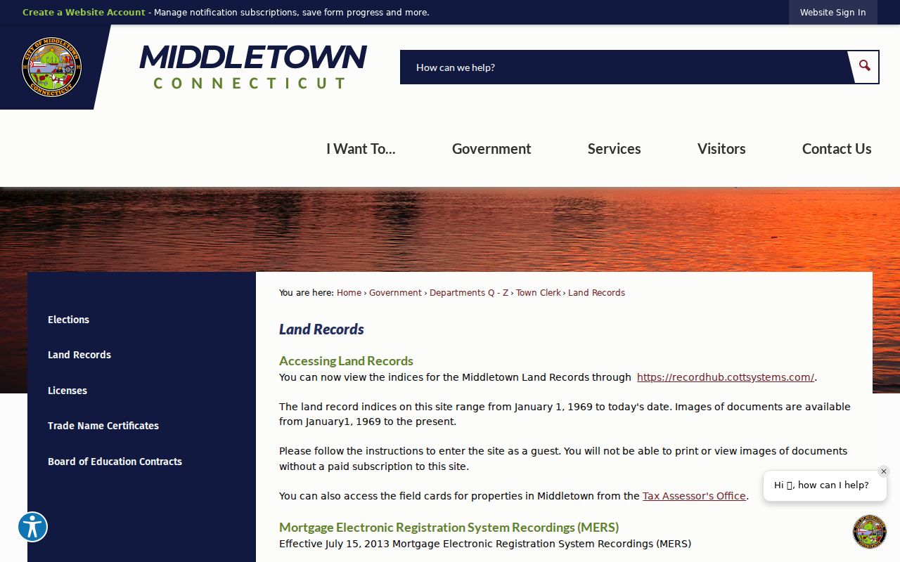
For a current parcel, search the owner as a grantee, open the likely purchase instrument, and record the grantor, grantee, date, instrument kind, number, book/page, description, reference, amount, and image indicator. Then search the prior grantor as an earlier grantee. Keep the legal description or map-lot beside the street address, because older records may describe the land without using today's number.
Before 1969, the fallback is the Town Clerk's deed books and index, Russell Library microfilm, and the early local index. Russell reports deeds from 1654 through 1907 and an early grantor-grantee and vital index from 1654 through 1855. A deed chain establishes recorded title. Directories, census, newspapers, probate, and vital records are needed to study occupants or family relationships.
Reverse Directories for Middletown Streets
When the question moves from a current parcel to a former household, use the reverse or street section of a historical directory. Russell Library describes directories from 1871 through 1990 with gaps. Wesleyan identifies Middletown directories from 1868 through 1927 in Special Collections and 1928 through 1980 in the stacks. These volumes can supply a street number, occupant, trade, spouse or household clue, and an alternate spelling for a later search.
The city-hosted scans and the shelf collections are covered in the Middletown city directories collection guide. Here, the practical street use is narrower: read the street section for the number, then turn to the alphabetic entry to check the person's trade, relationship notation, affiliations, and any abbreviation key. Do not treat a missing name as proof that no one lived there. A publication gap, move, death, temporary stay, spelling change, or publisher choice can all interrupt a run.
Pair a reverse entry with a second year two to five years away, a census year, a newspaper index, or a deed. That comparison is how an address guide becomes a historical street tool instead of a stand-alone claim about a household.
Middletown House Numbers Need Verification
No official Middletown list of old and new street numbers or renamed streets was located. Do not assign a renumbering year from a blank search result. The relevant authority is the Middletown Engineering Division, which handles house numbers, street names, and mapping at 245 deKoven Drive, phone 860-638-4862. Ask Engineering to confirm a current addressing question, then use the Town Clerk, legal description, and historical map evidence for the older record.
The bridge is a set of matching details: old and current street spelling, number, nearest intersection, map-lot, PID, legal description, adjacent parcel, Sanborn sheet, or Price and Lee map. Middletown's documented Sanborn years include 1884, 1889, 1895, 1901, 1907, 1913, and 1924. The 1907 Library of Congress set has 32 sheets. Route 9's late-1950s separation of downtown from the waterfront is another reason to compare a historic map with the current road network.
Note: When a number fails in an old volume, search the reverse section, street variants, map-lot, legal description, and nearby cross streets before concluding that the address or person was absent.
Limits of a Middletown Street Directory
A street directory can show a parcel owner, a public mailing address, a recorded party, a permit applicant, a historical occupant, or a public civic status, depending on the source. It cannot supply a complete list of household members, utility customers, mail recipients, DMV address holders, or people protected through Connecticut's Address Confidentiality Program. The MyVote route is designed for a person and a status or polling-place answer, not a street-wide public roster.
GIS Abutters is equally specific. It can create a CSV or PDF mailing list for parcels within a selected distance. It does not reveal every person physically present at an adjacent property. An owner mailing address can be out of town, belong to an entity, or serve several parcels. An owner, voter record, ZIP label, or map symbol therefore needs a plain description of what it proves and what it does not.
Lawful personal use. Middletown public records are for lawful research, family history, civic understanding, and similar legitimate purposes. Do not use an address trail to stalk, harass, intimidate, or harm anyone. Connecticut's official privacy and public-record rules, including protected-address programs, control what a custodian may release.
If the research goal becomes one named person rather than a street, use the Middletown resident lookup workflow and corroborate the name with a second record type. A careful by-street record is a map of record relationships, not a promise that every resident appears.